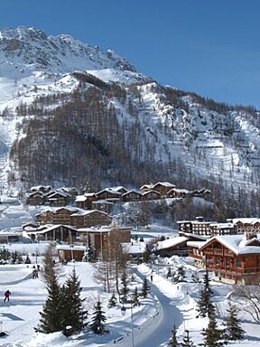

Val d'Isere on Orange alert for avalanches
High or Very high risk of avalanche in & around Val d'Isere
An orange alert has been issued by Meteo France today warning of the high risk of avalanches in the Savoie region over the next 24 hours.
Apparently this type of warning is only issued around once a year, and today's warning has been brought on by high snow fall and winds over the weekend.
Meteo France's statement reads:
Developments: After a first and significant snowfall between Saturday morning and Sunday morning on the mountains of Haute -Maurienne and Mercantour (30 to 60 cm of snow, accompanied by a strong south-easterly wind), a second episode, which started Sunday afternoon, brought 50 to 80 cm of additional snow in 24 hours also with a strong easterly and northeasterly wind (An additional 30 to 50 cm has already fallen during the night of Sunday to Monday).
Current situation: Heavy snowfall accompanied by a south-easterly wind and more or less strong (40 to 80 cm during the last 48 hours) has increased the avalanche risk to level 4. On Monday the risk in the Haute Tarentaise has increased to level 5 and the Upper Mauriennne
Evolution: The continued snowfall during the day today (Monday 29th) will be heavy and accompanied by a strong north-east wind, which will maintain the avalanche risk level 5 all day. As a result, many natural release of major avalanches are expected. These can affect the road infrastructure at altitude, which are usually threatened during episodes of very heavy snowfall.
-
Check for updates on the daily avalanche bulletin. In conditions like this it's best to stay on the pistes and to adhere to any roped off areas or closed pistes in resort, for your own safety.